
- Start >
- Groundwater >
- Waterlevel of upper layer >
- Bayern >
- Rohrbrunn S 1 >
- Current data

Current data Rohrbrunn S 1
Groundwater levels of the last 12 months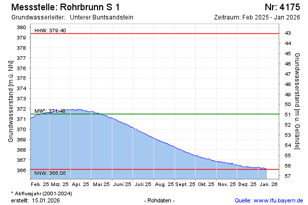
Groundwater level [m above sealevel]: 369.33
Distance to surface [m]: 53.11
Last value from 26.12.2024 09:54
Ground level [m above sealevel]: 422.44
| Date | Groundwater level [m above sealevel] |
|---|---|
| 26.12.2024 | 369.33 |
| 25.12.2024 | 369.32 |
| 24.12.2024 | 369.34 |
| 23.12.2024 | 369.41 |
| 22.12.2024 | 369.46 |
| 21.12.2024 | 369.38 |
| 20.12.2024 | 369.37 |
| 19.12.2024 | 369.45 |
© Bayerisches Landesamt für Umwelt 2024