
- Start >
- Groundwater >
- Waterlevel of upper layer >
- Bayern >
- ROTHMANNSTHAL 11 >
- Current data

Current data ROTHMANNSTHAL 11
Groundwater levels of the last 12 months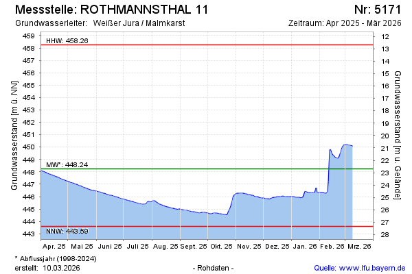
Groundwater level [m above sealevel]: 447.85
Distance to surface [m]: 23.08
Last value from 25.12.2024 09:00
Ground level [m above sealevel]: 470.93
| Date | Groundwater level [m above sealevel] |
|---|---|
| 24.12.2024 | 447.72 |
| 23.12.2024 | 447.63 |
| 22.12.2024 | 447.51 |
| 21.12.2024 | 447.44 |
| 20.12.2024 | 447.41 |
| 19.12.2024 | 447.40 |
| 18.12.2024 | 447.35 |
| 17.12.2024 | 447.31 |
© Bayerisches Landesamt für Umwelt 2024