
- Start >
- Groundwater >
- Waterlevel of upper layer >
- Bayern >
- SANKT AFRA (24404) >
- Current data

Current data SANKT AFRA (24404)
Groundwater levels of the last 12 months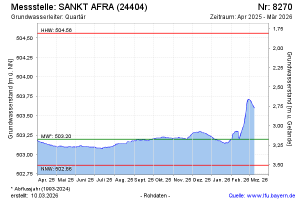
Groundwater level [m above sealevel]: 503.40
Distance to surface [m]: 2.97
Last value from 16.02.2025 09:00
Ground level [m above sealevel]: 506.37
| Date | Groundwater level [m above sealevel] |
|---|---|
| 16.02.2025 | 503.40 |
| 15.02.2025 | 503.41 |
| 14.02.2025 | 503.41 |
| 13.02.2025 | 503.42 |
| 12.02.2025 | 503.42 |
| 11.02.2025 | 503.43 |
| 10.02.2025 | 503.44 |
| 09.02.2025 | 503.45 |
© Bayerisches Landesamt für Umwelt 2025