
- Start >
- Groundwater >
- Waterlevel of upper layer >
- Bayern >
- SAUGENDORF BT-W2 >
- Chart of total period

Chart of total period SAUGENDORF BT-W2
Groundwater levels of the total period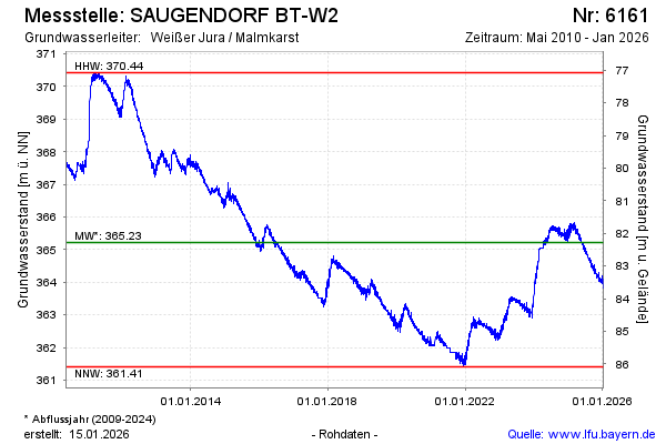
Groundwater level [m above sealevel]: 365.28
Distance to surface [m]: 82.22
Last value from 26.12.2024 10:00
Ground level [m above sealevel]: 447.50
| Date | Groundwater level [m above sealevel] |
|---|---|
| 26.12.2024 | 365.29 |
| 25.12.2024 | 365.27 |
| 24.12.2024 | 365.33 |
| 23.12.2024 | 365.49 |
| 22.12.2024 | 365.59 |
| 21.12.2024 | 365.44 |
| 20.12.2024 | 365.45 |
| 19.12.2024 | 365.60 |
© Bayerisches Landesamt für Umwelt 2024