
- Start >
- Groundwater >
- Waterlevel of upper layer >
- Bayern >
- Schachen B21 >
- Chart of total period

Chart of total period Schachen B21
Groundwater levels of the total period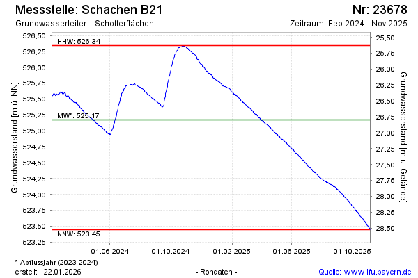
Groundwater level [m above sealevel]: 526.25
Distance to surface [m]: 25.72
Last value from 12.11.2024 11:34
Ground level [m above sealevel]: 551.97
| Date | Groundwater level [m above sealevel] |
|---|---|
| 03.07.2024 | 525.69 |
| 02.07.2024 | 525.68 |
| 01.07.2024 | 525.67 |
| 30.06.2024 | 525.66 |
| 29.06.2024 | 525.65 |
| 28.06.2024 | 525.63 |
| 27.06.2024 | 525.62 |
| 26.06.2024 | 525.60 |
© Bayerisches Landesamt für Umwelt 2024