
- Start >
- Groundwater >
- Waterlevel of upper layer >
- Bayern >
- SCHALKENTHAN B6 >
- Current data

Current data SCHALKENTHAN B6
Groundwater levels of the last 12 months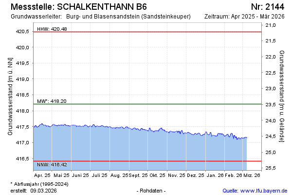
Groundwater level [m above sealevel]: 417.49
Distance to surface [m]: 24.21
Last value from 07.10.2024 10:00
Ground level [m above sealevel]: 441.70
| Date | Groundwater level [m above sealevel] |
|---|---|
| 07.10.2024 | 417.50 |
| 06.10.2024 | 417.48 |
| 05.10.2024 | 417.46 |
| 04.10.2024 | 417.46 |
| 03.10.2024 | 417.47 |
| 02.10.2024 | 417.51 |
| 01.10.2024 | 417.49 |
| 30.09.2024 | 417.45 |
© Bayerisches Landesamt für Umwelt 2024