
- Start >
- Groundwater >
- Waterlevel of upper layer >
- Bayern >
- SCHNAITSEE 588 >
- Chart of total period

Chart of total period SCHNAITSEE 588
Groundwater levels of the total period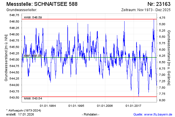
Groundwater level [m above sealevel]: 545.77
Distance to surface [m]: 5.63
Last value from 11.09.2024 10:00
Ground level [m above sealevel]: 551.40
| Date | Groundwater level [m above sealevel] |
|---|---|
| 11.09.2024 | 545.77 |
| 10.09.2024 | 545.76 |
| 09.09.2024 | 545.78 |
| 08.09.2024 | 545.79 |
| 07.09.2024 | 545.79 |
| 06.09.2024 | 545.81 |
| 05.09.2024 | 545.84 |
| 04.09.2024 | 545.84 |
© Bayerisches Landesamt für Umwelt 2024