
- Start >
- Groundwater >
- Waterlevel of upper layer >
- Bayern >
- SCHNEEBERG 179 >
- Current data

Current data SCHNEEBERG 179
Groundwater levels of the last 12 months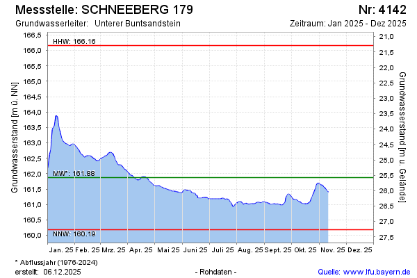
Groundwater level [m above sealevel]: 162.59
Distance to surface [m]: 24.90
Last value from 04.01.2025 10:00
Ground level [m above sealevel]: 187.49
| Date | Groundwater level [m above sealevel] |
|---|---|
| 04.01.2025 | 162.56 |
| 03.01.2025 | 162.41 |
| 02.01.2025 | 162.17 |
| 01.01.2025 | 162.12 |
| 31.12.2024 | 162.14 |
| 30.12.2024 | 162.17 |
| 29.12.2024 | 162.19 |
| 28.12.2024 | 162.20 |
© Bayerisches Landesamt für Umwelt 2025