
- Start >
- Groundwater >
- Waterlevel of upper layer >
- Bayern >
- Schnelldorf-Gailroth >
- Chart of total period

Chart of total period Schnelldorf-Gailroth
Groundwater levels of the total period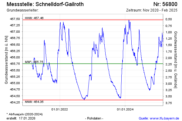
Groundwater level [m above sealevel]: 455.30
Distance to surface [m]: 2.64
Last value from 23.11.2024 13:00
Ground level [m above sealevel]: 457.94
| Date | Groundwater level [m above sealevel] |
|---|---|
| 23.11.2024 | 455.29 |
| 22.11.2024 | 455.35 |
| 21.11.2024 | 455.35 |
| 20.11.2024 | 455.22 |
| 19.11.2024 | 455.09 |
| 18.11.2024 | 454.97 |
| 17.11.2024 | 454.97 |
| 16.11.2024 | 454.96 |
© Bayerisches Landesamt für Umwelt 2024