
- Start >
- Groundwater >
- Waterlevel of upper layer >
- Bayern >
- Schweitenkirchen flach >
- Current data

Current data Schweitenkirchen flach
Groundwater levels of the last 12 months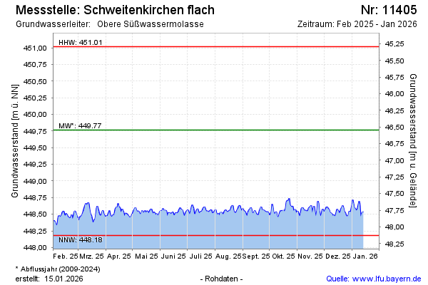
Groundwater level [m above sealevel]: 448.52
Distance to surface [m]: 47.79
Last value from 21.11.2024 10:00
Ground level [m above sealevel]: 496.31
| Date | Groundwater level [m above sealevel] |
|---|---|
| 21.11.2024 | 448.52 |
| 20.11.2024 | 448.59 |
| 19.11.2024 | 448.57 |
| 18.11.2024 | 448.50 |
| 17.11.2024 | 448.49 |
| 16.11.2024 | 448.44 |
| 15.11.2024 | 448.39 |
| 14.11.2024 | 448.38 |
© Bayerisches Landesamt für Umwelt 2024