
- Start >
- Groundwater >
- Waterlevel of upper layer >
- Bayern >
- TAFERTSHOFEN >
- Current data

Current data TAFERTSHOFEN
Groundwater levels of the last 12 months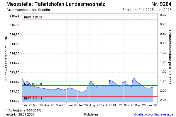
Groundwater level [m above sealevel]: 513.51
Distance to surface [m]: 1.76
Last value from 16.02.2025 09:12
Ground level [m above sealevel]: 515.27
| Date | Groundwater level [m above sealevel] |
|---|---|
| 16.02.2025 | 513.51 |
| 15.02.2025 | 513.50 |
| 14.02.2025 | 513.48 |
| 13.02.2025 | 513.45 |
| 12.02.2025 | 513.44 |
| 11.02.2025 | 513.44 |
| 10.02.2025 | 513.45 |
| 09.02.2025 | 513.46 |
© Bayerisches Landesamt für Umwelt 2025