
- Start >
- Groundwater >
- Waterlevel of upper layer >
- Bayern >
- TANNENHOLZ B 75 >
- Current data

Current data TANNENHOLZ B 75
Groundwater levels of the last 12 months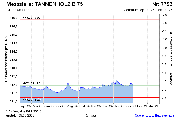
Groundwater level [m above sealevel]: 312.01
Distance to surface [m]: 1.70
Last value from 24.07.2024 11:20
Ground level [m above sealevel]: 313.71
| Date | Groundwater level [m above sealevel] |
|---|---|
| 24.07.2024 | 312.01 |
| 23.07.2024 | 312.01 |
| 22.07.2024 | 312.04 |
| 21.07.2024 | 312.11 |
| 20.07.2024 | 312.18 |
| 19.07.2024 | 312.25 |
| 18.07.2024 | 312.34 |
| 17.07.2024 | 312.41 |
© Bayerisches Landesamt für Umwelt 2024