
- Start >
- Groundwater >
- Waterlevel of upper layer >
- Bayern >
- Tennenlohe KMS 3 >
- Chart of total period

Chart of total period Tennenlohe KMS 3
Groundwater levels of the total period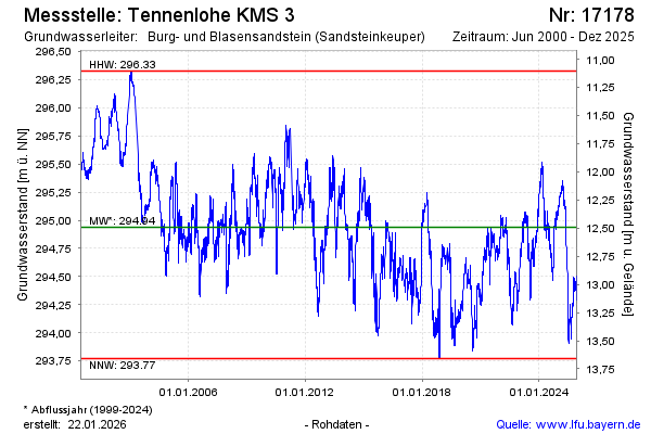
Groundwater level [m above sealevel]: 295.04
Distance to surface [m]: 12.39
Last value from 18.11.2024 09:48
Ground level [m above sealevel]: 307.43
| Date | Groundwater level [m above sealevel] |
|---|---|
| 08.10.2024 | 294.91 |
| 07.10.2024 | 294.90 |
| 06.10.2024 | 294.88 |
| 05.10.2024 | 294.86 |
| 04.10.2024 | 294.84 |
| 03.10.2024 | 294.83 |
| 02.10.2024 | 294.82 |
| 01.10.2024 | 294.79 |
© Bayerisches Landesamt für Umwelt 2024