
- Start >
- Groundwater >
- Waterlevel of upper layer >
- Bayern >
- Treuchtlingen-Dietfurt >
- Current data

Current data Treuchtlingen-Dietfurt
Groundwater levels of the last 12 months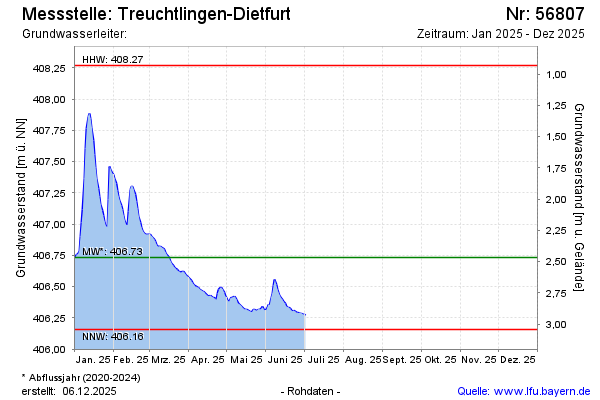
Groundwater level [m above sealevel]: 406.55
Distance to surface [m]: 2.65
Last value from 18.11.2024 10:00
Ground level [m above sealevel]: 409.20
| Date | Groundwater level [m above sealevel] |
|---|---|
| 19.09.2024 | 406.85 |
| 18.09.2024 | 406.87 |
| 17.09.2024 | 406.88 |
| 16.09.2024 | 406.79 |
| 15.09.2024 | 406.73 |
| 14.09.2024 | 406.71 |
| 13.09.2024 | 406.68 |
| 12.09.2024 | 406.68 |
© Bayerisches Landesamt für Umwelt 2024