
- Start >
- Groundwater >
- Waterlevel of upper layer >
- Bayern >
- Treuchtlingen-Dietfurt >
- Chart of total period

Chart of total period Treuchtlingen-Dietfurt
Groundwater levels of the total period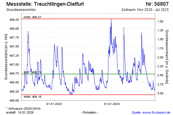
Groundwater level [m above sealevel]: 407.68
Distance to surface [m]: 1.52
Last value from 16.01.2025 10:00
Ground level [m above sealevel]: 409.20
| Date | Groundwater level [m above sealevel] |
|---|---|
| 16.01.2025 | 407.70 |
| 15.01.2025 | 407.77 |
| 14.01.2025 | 407.85 |
| 13.01.2025 | 407.89 |
| 12.01.2025 | 407.86 |
| 11.01.2025 | 407.77 |
| 10.01.2025 | 407.61 |
| 09.01.2025 | 407.36 |
© Bayerisches Landesamt für Umwelt 2025