
- Start >
- Groundwater >
- Waterlevel of upper layer >
- Bayern >
- UNTERE ISAR SP 57 >
- Current data

Current data UNTERE ISAR SP 57
Groundwater levels of the last 12 months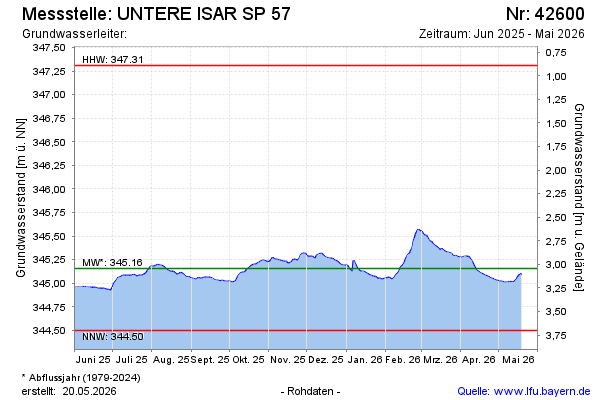
Groundwater level [m above sealevel]: 345.45
Distance to surface [m]: 2.75
Last value from 23.10.2024 09:15
Ground level [m above sealevel]: 348.20
| Date | Groundwater level [m above sealevel] |
|---|---|
| 23.10.2024 | 345.45 |
| 22.10.2024 | 345.46 |
| 21.10.2024 | 345.48 |
| 20.10.2024 | 345.50 |
| 19.10.2024 | 345.52 |
| 18.10.2024 | 345.53 |
| 17.10.2024 | 345.55 |
| 16.10.2024 | 345.56 |
© Bayerisches Landesamt für Umwelt 2024