
- Start >
- Groundwater >
- Waterlevel of upper layer >
- Bayern >
- UNTERE ISAR SP 60 >
- Chart of total period

Chart of total period UNTERE ISAR SP 60
Groundwater levels of the total period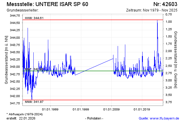
Groundwater level [m above sealevel]: 343.15
Distance to surface [m]: 2.39
Last value from 10.02.2025 10:40
Ground level [m above sealevel]: 345.54
| Date | Groundwater level [m above sealevel] |
|---|---|
| 10.02.2025 | 343.16 |
| 09.02.2025 | 343.16 |
| 08.02.2025 | 343.17 |
| 07.02.2025 | 343.18 |
| 06.02.2025 | 343.20 |
| 05.02.2025 | 343.21 |
| 04.02.2025 | 343.23 |
| 03.02.2025 | 343.24 |
© Bayerisches Landesamt für Umwelt 2025