
- Start >
- Groundwater >
- Waterlevel of upper layer >
- Bayern >
- UNTERE ISAR SP 64 >
- Current data

Current data UNTERE ISAR SP 64
Groundwater levels of the last 12 months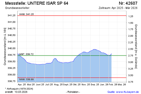
Groundwater level [m above sealevel]: 340.25
Distance to surface [m]: 2.22
Last value from 23.10.2024 10:15
Ground level [m above sealevel]: 342.47
| Date | Groundwater level [m above sealevel] |
|---|---|
| 23.10.2024 | 340.26 |
| 22.10.2024 | 340.26 |
| 21.10.2024 | 340.26 |
| 20.10.2024 | 340.27 |
| 19.10.2024 | 340.27 |
| 18.10.2024 | 340.28 |
| 17.10.2024 | 340.28 |
| 16.10.2024 | 340.27 |
© Bayerisches Landesamt für Umwelt 2024