
- Start >
- Groundwater >
- Waterlevel of upper layer >
- Bayern >
- UNTERLENGHART 94 >
- Year chart of precipitation

Year chart of precipitation UNTERLENGHART 94
Groundwater levels of the last 12 months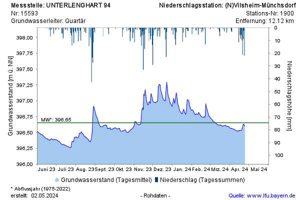
Groundwater level [m above sealevel]: 396,80
Distance to surface [m]: 1,38
Last value from 07.01.2025 12:25
Ground level [m above sealevel]: 398.18
© Bayerisches Landesamt für Umwelt 2025