
- Start >
- Groundwater >
- Waterlevel of upper layer >
- Bayern >
- VB C Trebgasttal >
- Chart of total period

Chart of total period VB C Trebgasttal
Groundwater levels of the total period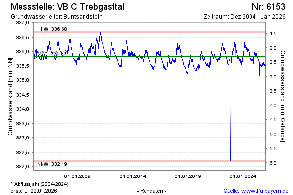
Groundwater level [m above sealevel]: 335.91
Distance to surface [m]: 2.22
Last value from 15.01.2025 09:00
Ground level [m above sealevel]: 338.13
Date | Groundwater level [m above sealevel] |
|---|---|
| 15.01.2025 | 335.91 |
| 14.01.2025 | 335.88 |
| 13.01.2025 | 335.84 |
| 12.01.2025 | 335.85 |
| 11.01.2025 | 335.88 |
| 10.01.2025 | 335.88 |
| 09.01.2025 | 335.91 |
| 08.01.2025 | 335.88 |
© Bayerisches Landesamt für Umwelt 2025