
- Start >
- Groundwater >
- Waterlevel of upper layer >
- Bayern >
- Volkach MU 16 >
- Chart of total period

Chart of total period Volkach MU 16
Groundwater levels of the total period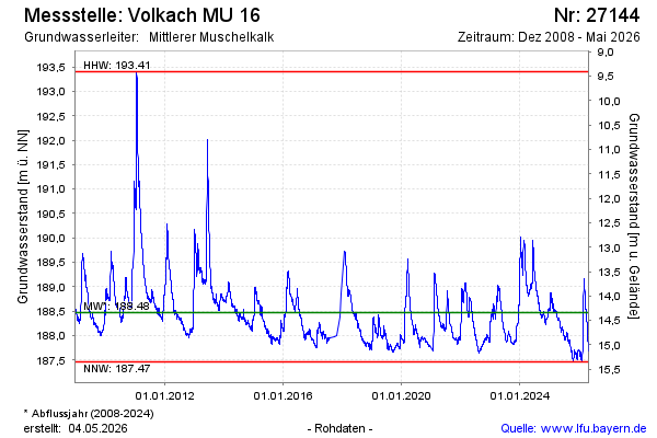
Groundwater level [m above sealevel]: 188.49
Distance to surface [m]: 14.32
Last value from 18.10.2024 10:00
Ground level [m above sealevel]: 202.81
| Date | Groundwater level [m above sealevel] |
|---|---|
| 17.10.2024 | 188.49 |
| 16.10.2024 | 188.49 |
| 15.10.2024 | 188.45 |
| 14.10.2024 | 188.44 |
| 13.10.2024 | 188.43 |
| 12.10.2024 | 188.43 |
| 11.10.2024 | 188.39 |
| 10.10.2024 | 188.40 |
© Bayerisches Landesamt für Umwelt 2024