
- Start >
- Groundwater >
- Waterlevel of upper layer >
- Bayern >
- Volkersdorf >
- Chart of total period

Chart of total period Volkersdorf
Groundwater levels of the total period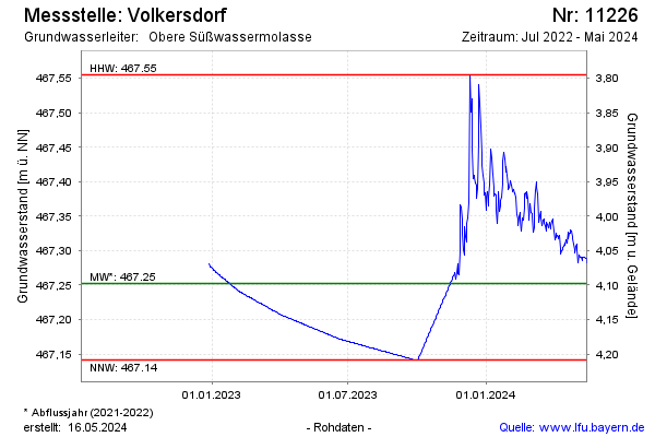
note
Datensammler defekt
Groundwater level [m above sealevel]: 467.51
Distance to surface [m]: 3.84
Last value from 16.02.2025 10:00
Ground level [m above sealevel]: 471.35
| Date | Groundwater level [m above sealevel] |
|---|---|
| 16.02.2025 | 467.51 |
| 15.02.2025 | 467.51 |
| 14.02.2025 | 467.50 |
| 13.02.2025 | 467.50 |
| 12.02.2025 | 467.49 |
| 11.02.2025 | 467.49 |
| 10.02.2025 | 467.49 |
| 09.02.2025 | 467.48 |
© Bayerisches Landesamt für Umwelt 2025