
- Start >
- Groundwater >
- Waterlevel of upper layer >
- Bayern >
- Waal Spitalwald B 2 >
- Current data

Current data Waal Spitalwald B 2
Groundwater levels of the last 12 months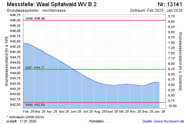
Groundwater level [m above sealevel]: 645.31
Distance to surface [m]: 7.13
Last value from 12.01.2025 10:00
Ground level [m above sealevel]: 652.44
| Date | Groundwater level [m above sealevel] |
|---|---|
| 12.01.2025 | 645.31 |
| 11.01.2025 | 645.30 |
| 10.01.2025 | 645.29 |
| 09.01.2025 | 645.28 |
| 08.01.2025 | 645.27 |
| 07.01.2025 | 645.27 |
| 06.01.2025 | 645.28 |
| 05.01.2025 | 645.28 |
© Bayerisches Landesamt für Umwelt 2025