
- Start >
- Groundwater >
- Waterlevel of upper layer >
- Bayern >
- Walchsing Ort >
- Chart of total period

Chart of total period Walchsing Ort
Groundwater levels of the total period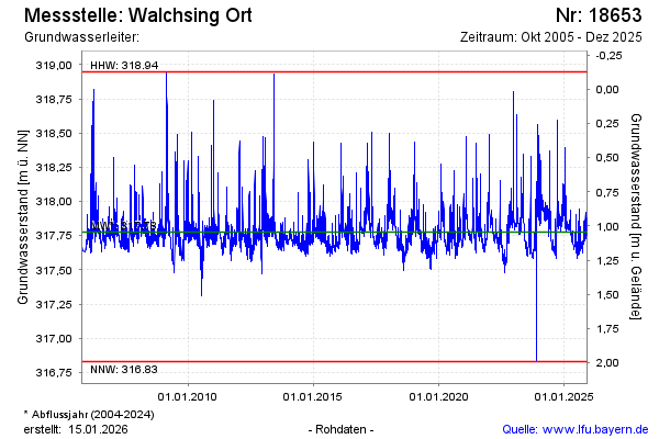
note
GW Messtelle im SN Flussraum Vils
Groundwater level [m above sealevel]: 317.90
Distance to surface [m]: 0.92
Last value from 06.02.2025 11:00
Ground level [m above sealevel]: 318.82
| Date | Groundwater level [m above sealevel] |
|---|---|
| 05.02.2025 | 317.89 |
| 04.02.2025 | 317.89 |
| 03.02.2025 | 317.92 |
| 02.02.2025 | 317.94 |
| 01.02.2025 | 317.96 |
| 31.01.2025 | 318.01 |
| 30.01.2025 | 318.07 |
| 29.01.2025 | 317.96 |
© Bayerisches Landesamt für Umwelt 2025