
- Start >
- Groundwater >
- Waterlevel of upper layer >
- Bayern >
- Walchsing Ort >
- Chart of total period

Chart of total period Walchsing Ort
Groundwater levels of the total period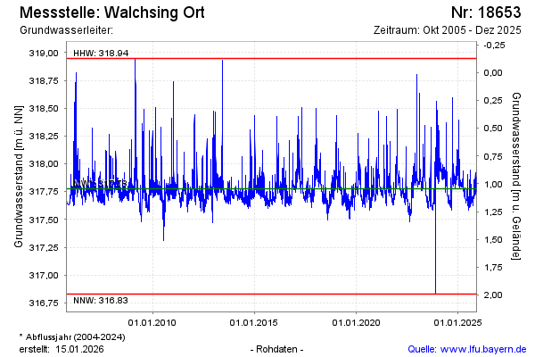
note
GW Messtelle im SN Flussraum Vils
Groundwater level [m above sealevel]: 317.84
Distance to surface [m]: 0.98
Last value from 24.10.2024 09:50
Ground level [m above sealevel]: 318.82
| Date | Groundwater level [m above sealevel] |
|---|---|
| 24.10.2024 | 317.84 |
| 23.10.2024 | 317.82 |
| 22.10.2024 | 317.83 |
| 21.10.2024 | 317.84 |
| 20.10.2024 | 317.86 |
| 19.10.2024 | 317.84 |
| 18.10.2024 | 317.87 |
| 17.10.2024 | 317.86 |
© Bayerisches Landesamt für Umwelt 2024