
- Start >
- Groundwater >
- Waterlevel of upper layer >
- Bayern >
- Wassertrüdingen HW GWM 2 >
- Chart of total period

Chart of total period Wassertrüdingen HW GWM 2
Groundwater levels of the total period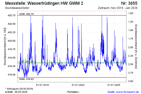
Groundwater level [m above sealevel]: 419.44
Distance to surface [m]: 2.33
Last value from 27.11.2024 11:27
Ground level [m above sealevel]: 421.77
| Date | Groundwater level [m above sealevel] |
|---|---|
| 27.11.2024 | 419.42 |
| 26.11.2024 | 419.40 |
| 25.11.2024 | 419.41 |
| 24.11.2024 | 419.45 |
| 23.11.2024 | 419.52 |
| 22.11.2024 | 419.69 |
| 21.11.2024 | 419.74 |
| 20.11.2024 | 419.60 |
© Bayerisches Landesamt für Umwelt 2025