
- Start >
- Groundwater >
- Waterlevel of upper layer >
- Bayern >
- WEIDENSTAUDE >
- Chart of total period

Chart of total period WEIDENSTAUDE
Groundwater levels of the total period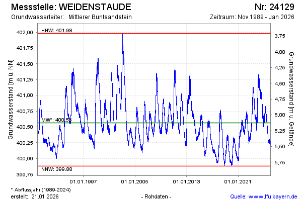
Groundwater level [m above sealevel]: 400.63
Distance to surface [m]: 5.06
Last value from 04.11.2024 11:30
Ground level [m above sealevel]: 405.69
| Date | Groundwater level [m above sealevel] |
|---|---|
| 19.08.2024 | 401.03 |
| 10.07.2024 | 400.99 |
| 10.06.2024 | 401.08 |
| 15.04.2024 | 401.23 |
| 11.03.2024 | 401.27 |
| 22.01.2024 | 400.96 |
| 29.11.2023 | 400.56 |
| 28.11.2023 | 400.61 |
© Bayerisches Landesamt für Umwelt 2024