
- Start >
- Groundwater >
- Waterlevel of upper layer >
- Bayern >
- WEMDING 48C >
- Chart of total period

Chart of total period WEMDING 48C
Groundwater levels of the total period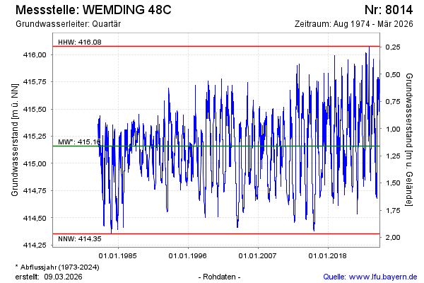
Groundwater level [m above sealevel]: 415.56
Distance to surface [m]: 0.76
Last value from 12.03.2025 12:00
Ground level [m above sealevel]: 416.32
| Date | Groundwater level [m above sealevel] |
|---|---|
| 12.03.2025 | 415.56 |
| 11.03.2025 | 415.56 |
| 10.03.2025 | 415.57 |
| 09.03.2025 | 415.57 |
| 08.03.2025 | 415.58 |
| 07.03.2025 | 415.59 |
| 06.03.2025 | 415.60 |
| 05.03.2025 | 415.61 |
© Bayerisches Landesamt für Umwelt 2025