
- Start >
- Groundwater >
- Waterlevel of upper layer >
- Bayern >
- Wenzsiedlung 2 >
- Chart of total period

Chart of total period Wenzsiedlung 2
Groundwater levels of the total period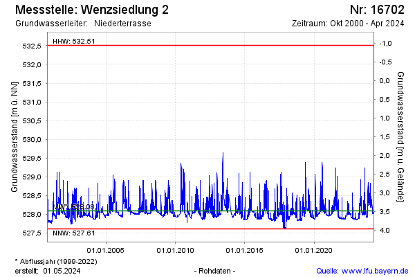
Groundwater level [m above sealevel]: 527.89
Distance to surface [m]: 3.68
Last value from 29.12.2024 10:00
Ground level [m above sealevel]: 531.57
| Date | Groundwater level [m above sealevel] |
|---|---|
| 29.12.2024 | 527.89 |
| 28.12.2024 | 527.89 |
| 27.12.2024 | 527.89 |
| 26.12.2024 | 527.90 |
| 25.12.2024 | 527.91 |
| 24.12.2024 | 527.92 |
| 23.12.2024 | 527.93 |
| 22.12.2024 | 527.93 |
© Bayerisches Landesamt für Umwelt 2024