
- Start >
- Groundwater >
- Waterlevel of upper layer >
- Bayern >
- WESTERHAM,SUEDL. R 7 >
- Current data

Current data WESTERHAM,SUEDL. R 7
Groundwater levels of the last 12 months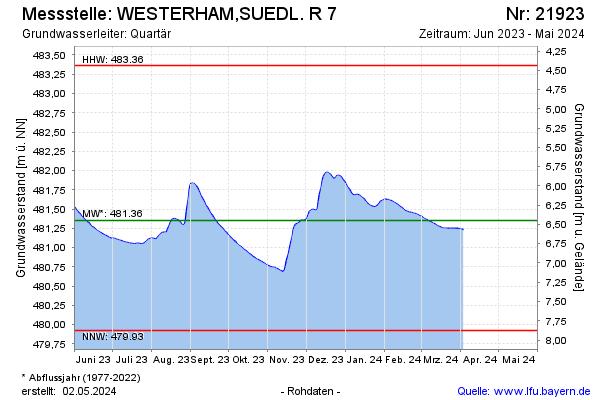
Groundwater level [m above sealevel]: 482.01
Distance to surface [m]: 5.74
Last value from 10.12.2024 11:56
Ground level [m above sealevel]: 487.75
| Date | Groundwater level [m above sealevel] |
|---|---|
| 10.12.2024 | 482.00 |
| 09.12.2024 | 481.99 |
| 08.12.2024 | 481.98 |
| 07.12.2024 | 481.97 |
| 06.12.2024 | 481.97 |
| 05.12.2024 | 481.97 |
| 04.12.2024 | 481.97 |
| 03.12.2024 | 481.98 |
© Bayerisches Landesamt für Umwelt 2024