
- Start >
- Groundwater >
- Waterlevel of upper layer >
- Bayern >
- WETTSTETTEN II 635 >
- Chart of total period

Chart of total period WETTSTETTEN II 635
Groundwater levels of the total period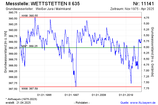
Groundwater level [m above sealevel]: 389.46
Distance to surface [m]: 5.82
Last value from 03.12.2024 10:00
Ground level [m above sealevel]: 395.28
| Date | Groundwater level [m above sealevel] |
|---|---|
| 03.12.2024 | 389.46 |
| 02.12.2024 | 389.46 |
| 01.12.2024 | 389.45 |
| 30.11.2024 | 389.45 |
| 29.11.2024 | 389.45 |
| 28.11.2024 | 389.46 |
| 27.11.2024 | 389.46 |
| 26.11.2024 | 389.46 |
© Bayerisches Landesamt für Umwelt 2024