
- Start >
- Groundwater >
- Waterlevel of upper layer >
- Oberer Main - Elbe >
- Hallstadt 16 >
- Chart of total period

Chart of total period Hallstadt 16
Groundwater levels of the total period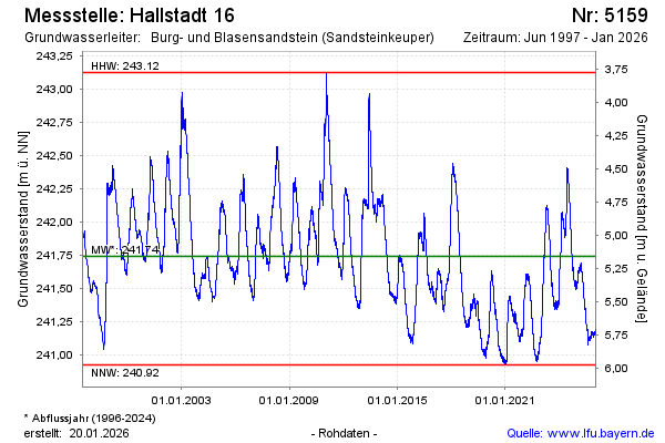
Groundwater level [m above sealevel]: 241.54
Distance to surface [m]: 5.36
Last value from 03.01.2025 10:00
Ground level [m above sealevel]: 246.90
| Date | Groundwater level [m above sealevel] |
|---|---|
| 03.01.2025 | 241.54 |
| 02.01.2025 | 241.54 |
| 01.01.2025 | 241.53 |
| 31.12.2024 | 241.52 |
| 30.12.2024 | 241.52 |
| 29.12.2024 | 241.52 |
| 28.12.2024 | 241.52 |
| 27.12.2024 | 241.51 |
© Bayerisches Landesamt für Umwelt 2025