
- Start >
- Groundwater >
- Waterlevel of upper layer >
- Oberer Main - Elbe >
- Kastl >
- Current data

Current data Kastl
Groundwater levels of the last 12 months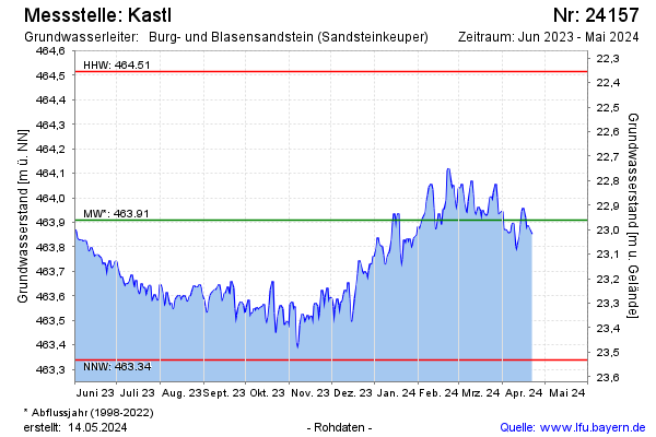
Groundwater level [m above sealevel]: 463.59
Distance to surface [m]: 23.28
Last value from 25.11.2024 11:54
Ground level [m above sealevel]: 486.87
| Date | Groundwater level [m above sealevel] |
|---|---|
| 25.11.2024 | 463.57 |
| 24.11.2024 | 463.55 |
| 23.11.2024 | 463.52 |
| 22.11.2024 | 463.62 |
| 21.11.2024 | 463.65 |
| 20.11.2024 | 463.67 |
| 19.11.2024 | 463.68 |
| 18.11.2024 | 463.64 |
© Bayerisches Landesamt für Umwelt 2024