
- Start >
- Groundwater >
- Waterlevel of upper layer >
- Oberer Main - Elbe >
- LIMMERSDORFER FORST-kms2 >
- Current data

Current data LIMMERSDORFER FORST-kms2
Groundwater levels of the last 12 months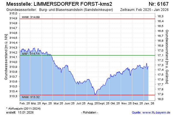
Groundwater level [m above sealevel]: 314.20
Distance to surface [m]: 17.04
Last value from 03.01.2025 09:00
Ground level [m above sealevel]: 331.24
| Date | Groundwater level [m above sealevel] |
|---|---|
| 03.01.2025 | 314.17 |
| 02.01.2025 | 314.21 |
| 01.01.2025 | 314.17 |
| 31.12.2024 | 314.14 |
| 30.12.2024 | 314.13 |
| 29.12.2024 | 314.14 |
| 28.12.2024 | 314.13 |
| 27.12.2024 | 314.12 |
© Bayerisches Landesamt für Umwelt 2025