
- Start >
- Groundwater >
- Waterlevel of upper layer >
- Oberer Main - Elbe >
- Lohr KMS2 >
- Chart of total period

Chart of total period Lohr KMS2
Groundwater levels of the total period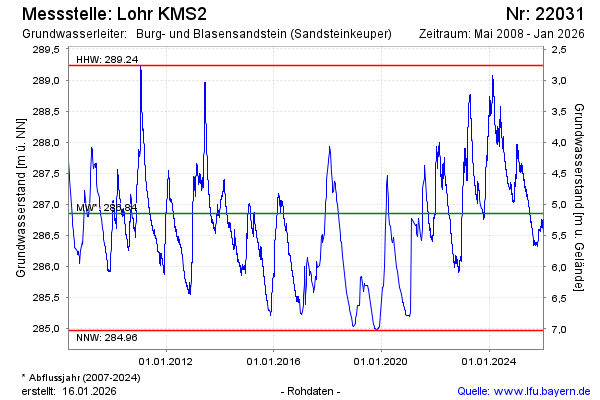
Groundwater level [m above sealevel]: 287.61
Distance to surface [m]: 4.39
Last value from 16.02.2025 10:00
Ground level [m above sealevel]: 292.00
| Date | Groundwater level [m above sealevel] |
|---|---|
| 16.02.2025 | 287.62 |
| 15.02.2025 | 287.62 |
| 14.02.2025 | 287.62 |
| 13.02.2025 | 287.65 |
| 12.02.2025 | 287.66 |
| 11.02.2025 | 287.67 |
| 10.02.2025 | 287.68 |
| 09.02.2025 | 287.70 |
© Bayerisches Landesamt für Umwelt 2025