
- Start >
- Groundwater >
- Waterlevel of upper layer >
- Oberer Main - Elbe >
- Lohr KMS2 >
- Current data

Current data Lohr KMS2
Groundwater levels of the last 12 months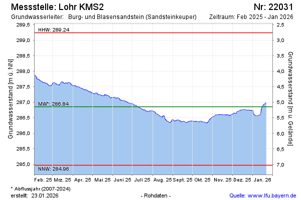
Groundwater level [m above sealevel]: 287.45
Distance to surface [m]: 4.55
Last value from 26.12.2024 10:00
Ground level [m above sealevel]: 292.00
| Date | Groundwater level [m above sealevel] |
|---|---|
| 26.12.2024 | 287.46 |
| 25.12.2024 | 287.45 |
| 24.12.2024 | 287.44 |
| 23.12.2024 | 287.47 |
| 22.12.2024 | 287.46 |
| 21.12.2024 | 287.35 |
| 20.12.2024 | 287.29 |
| 19.12.2024 | 287.33 |
© Bayerisches Landesamt für Umwelt 2024