
- Start >
- Groundwater >
- Waterlevel of upper layer >
- Oberer Main - Elbe >
- RATTELSDORF 136 >
- Chart of total period

Chart of total period RATTELSDORF 136
Groundwater levels of the total period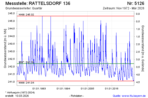
Groundwater level [m above sealevel]: 241.89
Distance to surface [m]: 3.58
Last value from 12.03.2025 08:00
Ground level [m above sealevel]: 245.47
| Date | Groundwater level [m above sealevel] |
|---|---|
| 12.03.2025 | 241.89 |
| 11.03.2025 | 241.89 |
| 10.03.2025 | 241.90 |
| 09.03.2025 | 241.90 |
| 08.03.2025 | 241.89 |
| 07.03.2025 | 241.89 |
| 06.03.2025 | 241.89 |
| 05.03.2025 | 241.89 |
© Bayerisches Landesamt für Umwelt 2025