
- Start >
- Groundwater >
- Waterlevel of upper layer >
- Oberer Main - Elbe >
- STAFFELSTEIN 33B >
- Current data

Current data STAFFELSTEIN 33B
Groundwater levels of the last 12 months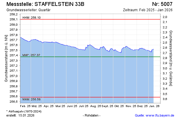
Groundwater level [m above sealevel]: 257.69
Distance to surface [m]: 2.46
Last value from 15.02.2025 09:01
Ground level [m above sealevel]: 260.15
| Date | Groundwater level [m above sealevel] |
|---|---|
| 15.02.2025 | 257.69 |
| 14.02.2025 | 257.69 |
| 13.02.2025 | 257.70 |
| 12.02.2025 | 257.70 |
| 11.02.2025 | 257.71 |
| 10.02.2025 | 257.71 |
| 09.02.2025 | 257.71 |
| 08.02.2025 | 257.72 |
© Bayerisches Landesamt für Umwelt 2025