
- Start >
- Groundwater >
- Waterlevel of upper layer >
- Oberer Main - Elbe >
- STAFFELSTEIN 33B >
- Chart of total period

Chart of total period STAFFELSTEIN 33B
Groundwater levels of the total period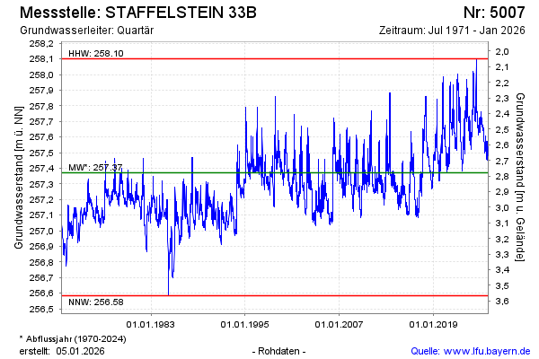
Groundwater level [m above sealevel]: 257.71
Distance to surface [m]: 2.44
Last value from 26.12.2024 09:01
Ground level [m above sealevel]: 260.15
| Date | Groundwater level [m above sealevel] |
|---|---|
| 26.12.2024 | 257.71 |
| 25.12.2024 | 257.71 |
| 24.12.2024 | 257.72 |
| 23.12.2024 | 257.73 |
| 22.12.2024 | 257.72 |
| 21.12.2024 | 257.71 |
| 20.12.2024 | 257.70 |
| 19.12.2024 | 257.70 |
© Bayerisches Landesamt für Umwelt 2024