
- Start >
- Groundwater >
- Waterlevel of upper layer >
- Iller - Lech - Bodensee >
- DERCHING 638 A >
- Current data

Current data DERCHING 638 A
Groundwater levels of the last 12 months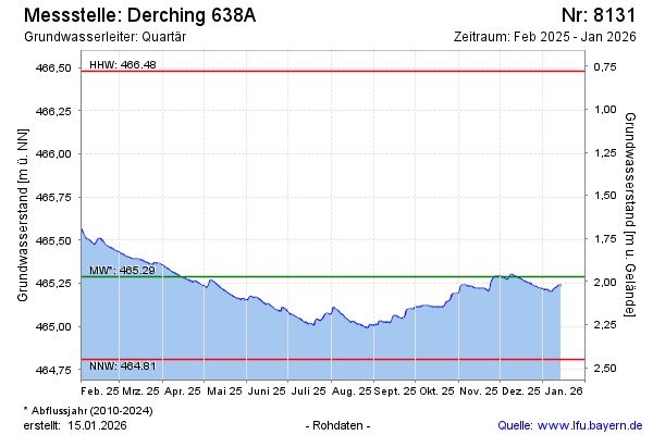
Groundwater level [m above sealevel]: 465.39
Distance to surface [m]: 1.87
Last value from 13.03.2025 09:00
Ground level [m above sealevel]: 467.26
| Date | Groundwater level [m above sealevel] |
|---|---|
| 13.03.2025 | 465.39 |
| 12.03.2025 | 465.39 |
| 11.03.2025 | 465.39 |
| 10.03.2025 | 465.39 |
| 09.03.2025 | 465.39 |
| 08.03.2025 | 465.40 |
| 07.03.2025 | 465.40 |
| 06.03.2025 | 465.40 |
© Bayerisches Landesamt für Umwelt 2025