
- Start >
- Groundwater >
- Waterlevel of upper layer >
- Iller - Lech - Bodensee >
- GWM 7T/23 HRB Westerheim WWA Kempten >
- Current data

Current data GWM 7T/23 HRB Westerheim WWA Kempten
Groundwater levels of the last 12 months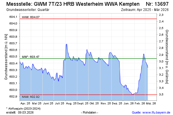
Groundwater level [m above sealevel]: 603.32
Distance to surface [m]: 3.11
Last value from 15.04.2025 09:00
Ground level [m above sealevel]: 606.43
Date | Groundwater level [m above sealevel] |
|---|---|
| 15.04.2025 | 603.32 |
| 14.04.2025 | 603.31 |
| 13.04.2025 | 603.32 |
| 12.04.2025 | 603.32 |
| 11.04.2025 | 603.35 |
| 10.04.2025 | 603.39 |
| 09.04.2025 | 603.41 |
| 08.04.2025 | 603.39 |
© Bayerisches Landesamt für Umwelt 2025