
- Start >
- Groundwater >
- Waterlevel of upper layer >
- Iller - Lech - Bodensee >
- UNTEREICHEN 931 >
- Chart of total period

Chart of total period UNTEREICHEN 931
Groundwater levels of the total period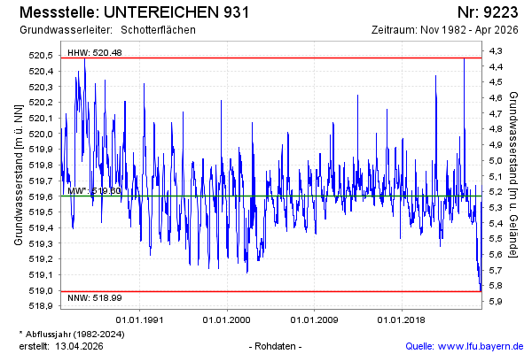
Groundwater level [m above sealevel]: 519.58
Distance to surface [m]: 5.25
Last value from 15.10.2024 09:00
Ground level [m above sealevel]: 524.83
| Date | Groundwater level [m above sealevel] |
|---|---|
| 15.10.2024 | 519.59 |
| 14.10.2024 | 519.59 |
| 13.10.2024 | 519.60 |
| 12.10.2024 | 519.61 |
| 11.10.2024 | 519.62 |
| 10.10.2024 | 519.63 |
| 09.10.2024 | 519.64 |
| 08.10.2024 | 519.64 |
© Bayerisches Landesamt für Umwelt 2024