
- Start >
- Groundwater >
- Waterlevel of upper layer >
- Iller - Lech - Bodensee >
- Waal Spitalwald B 2 >
- Current data

Current data Waal Spitalwald B 2
Groundwater levels of the last 12 months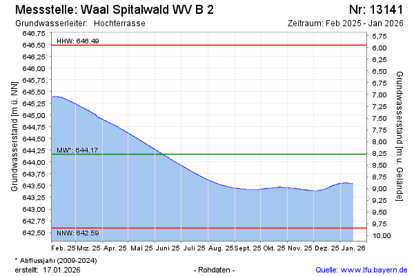
Groundwater level [m above sealevel]: 645.36
Distance to surface [m]: 7.08
Last value from 15.02.2025 10:00
Ground level [m above sealevel]: 652.44
| Date | Groundwater level [m above sealevel] |
|---|---|
| 15.02.2025 | 645.36 |
| 14.02.2025 | 645.36 |
| 13.02.2025 | 645.37 |
| 12.02.2025 | 645.37 |
| 11.02.2025 | 645.38 |
| 10.02.2025 | 645.38 |
| 09.02.2025 | 645.38 |
| 08.02.2025 | 645.39 |
© Bayerisches Landesamt für Umwelt 2025