
- Start >
- Groundwater >
- Waterlevel of upper layer >
- Inn >
- Altoetting 782 >
- Chart of total period

Chart of total period Altoetting 782
Groundwater levels of the total period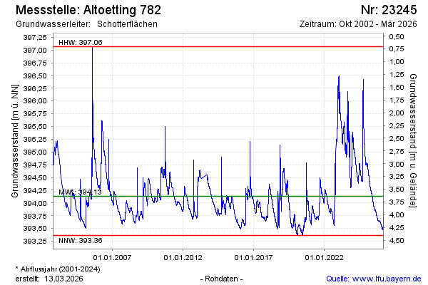
Groundwater level [m above sealevel]: 394.57
Distance to surface [m]: 3.20
Last value from 15.02.2025 09:00
Ground level [m above sealevel]: 397.77
| Date | Groundwater level [m above sealevel] |
|---|---|
| 15.02.2025 | 394.58 |
| 14.02.2025 | 394.58 |
| 13.02.2025 | 394.59 |
| 12.02.2025 | 394.59 |
| 11.02.2025 | 394.60 |
| 10.02.2025 | 394.61 |
| 09.02.2025 | 394.61 |
| 08.02.2025 | 394.62 |
© Bayerisches Landesamt für Umwelt 2025