
- Start >
- Groundwater >
- Waterlevel of upper layer >
- Inn >
- FELDOLLING R 34 >
- Current data

Current data FELDOLLING R 34
Groundwater levels of the last 12 months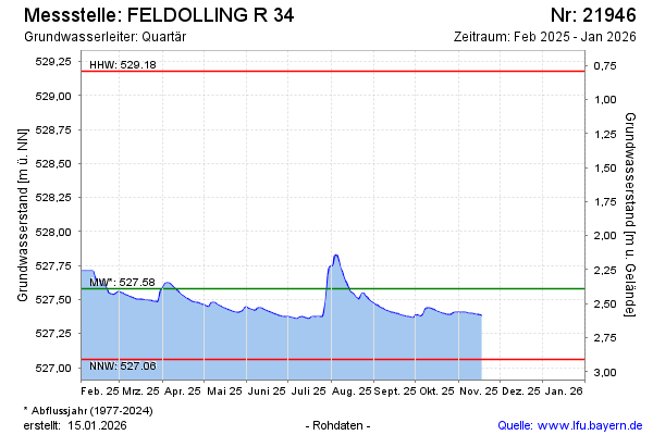
Groundwater level [m above sealevel]: 527.56
Distance to surface [m]: 2.33
Last value from 20.02.2025 12:17
Ground level [m above sealevel]: 529.89
| Date | Groundwater level [m above sealevel] |
|---|---|
| 20.02.2025 | 527.59 |
| 19.02.2025 | 527.60 |
| 18.02.2025 | 527.60 |
| 17.02.2025 | 527.63 |
| 16.02.2025 | 527.63 |
| 15.02.2025 | 527.63 |
| 14.02.2025 | 527.63 |
| 13.02.2025 | 527.63 |
© Bayerisches Landesamt für Umwelt 2025