
- Start >
- Groundwater >
- Waterlevel of upper layer >
- Inn >
- Fridolfing GWM2 >
- Current data

Current data Fridolfing GWM2
Groundwater levels of the last 12 months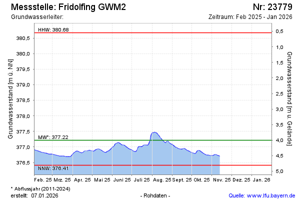
Groundwater level [m above sealevel]: 376.73
Distance to surface [m]: 4.49
Last value from 06.03.2025 14:00
Ground level [m above sealevel]: 381.22
| Date | Groundwater level [m above sealevel] |
|---|---|
| 31.12.2024 | 377.05 |
| 30.12.2024 | 377.06 |
| 29.12.2024 | 377.06 |
| 28.12.2024 | 377.07 |
| 27.12.2024 | 377.07 |
| 26.12.2024 | 377.07 |
| 25.12.2024 | 377.08 |
| 24.12.2024 | 377.07 |
© Bayerisches Landesamt für Umwelt 2025