
- Start >
- Groundwater >
- Waterlevel of upper layer >
- Inn >
- G5 HRB Feldolling >
- Chart of total period

Chart of total period G5 HRB Feldolling
Groundwater levels of the total period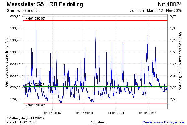
Groundwater level [m above sealevel]: 529.29
Distance to surface [m]: 2.10
Last value from 11.02.2025 13:02
Ground level [m above sealevel]: 531.39
| Date | Groundwater level [m above sealevel] |
|---|---|
| 11.02.2025 | 529.52 |
| 10.02.2025 | 529.53 |
| 09.02.2025 | 529.53 |
| 08.02.2025 | 529.53 |
| 07.02.2025 | 529.54 |
| 06.02.2025 | 529.54 |
| 05.02.2025 | 529.55 |
| 04.02.2025 | 529.55 |
© Bayerisches Landesamt für Umwelt 2025