
- Start >
- Groundwater >
- Waterlevel of upper layer >
- Inn >
- Gangkofen B 25 >
- Current data

Current data Gangkofen B 25
Groundwater levels of the last 12 months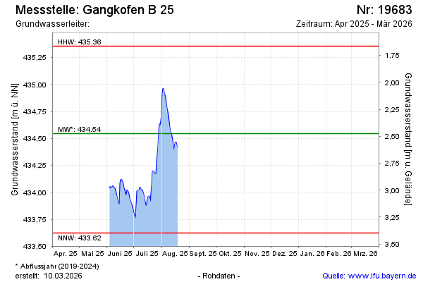
Groundwater level [m above sealevel]: 434.94
Distance to surface [m]: 2.08
Last value from 19.12.2024 09:00
Ground level [m above sealevel]: 437.02
| Date | Groundwater level [m above sealevel] |
|---|---|
| 19.12.2024 | 434.93 |
| 18.12.2024 | 434.93 |
| 17.12.2024 | 434.94 |
| 16.12.2024 | 434.96 |
| 15.12.2024 | 434.97 |
| 14.12.2024 | 435.03 |
| 13.12.2024 | 435.05 |
| 12.12.2024 | 435.09 |
© Bayerisches Landesamt für Umwelt 2025