
- Start >
- Groundwater >
- Waterlevel of upper layer >
- Inn >
- GRAFING T2 >
- Year chart of precipitation

Year chart of precipitation GRAFING T2
Groundwater levels of the last 12 months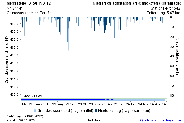
Groundwater level [m above sealevel]: 432,39
Distance to surface [m]: 3,65
Last value from 13.03.2025 07:00
Ground level [m above sealevel]: 436.04
© Bayerisches Landesamt für Umwelt 2025