
- Start >
- Groundwater >
- Waterlevel of upper layer >
- Inn >
- HINRICHSSEGEN R 31 >
- Chart of total period

Chart of total period HINRICHSSEGEN R 31
Groundwater levels of the total period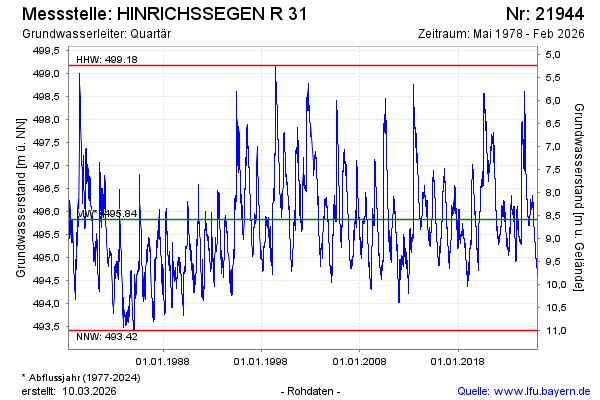
Groundwater level [m above sealevel]: 495.86
Distance to surface [m]: 8.56
Last value from 05.02.2025 13:53
Ground level [m above sealevel]: 504.42
| Date | Groundwater level [m above sealevel] |
|---|---|
| 05.02.2025 | 495.85 |
| 04.02.2025 | 495.85 |
| 03.02.2025 | 495.87 |
| 02.02.2025 | 495.88 |
| 01.02.2025 | 495.89 |
| 31.01.2025 | 495.90 |
| 30.01.2025 | 495.92 |
| 29.01.2025 | 495.95 |
© Bayerisches Landesamt für Umwelt 2025